|
The lake, the colours, the mountains - this place has most of the
things offered by Queenstown, but is less crowded. Best of all, it
has something that can keep Edith there for the whole day - the Puzzling
World!
We first discovered the Puzzling World 18 years ago when touring the
South Island with our family. The 3-D maze is still
there. The hologram hall has been expanded, and there're more free
puzzles to be solved at the cafe!
Take a look at the Roman's toilet pictured on your right.
Apparently Roman toilets often had running water under the seats (flush
toilets). Romans also carried a brush as part of their personal
toiletries (didn't have toilet paper in those days!).
While the Tower of Pisa leans 6 degrees, the amazing Leaning Tower of
Wanaka leans almost 53 degrees!
Look carefully at the clock on the tower. It goes backwards! On
the dot of the year 2000, the clock started to go back in time - back into
the 20th century!
|

Hang glider -
captured on the scenic route from Queenstown to Wanaka up the Crown Range |
|

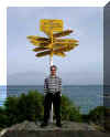
Land's End, Bluff |
Bluff
... the town where the highway begins
Bluff is the oldest European town in New Zealand. It's also where
Highway One begins and ends.
To experience New Zealand, there're two things one must try and see in
Bluff. One is the world famous Bluff
Oyster. Once you've tried it, you won't want anything else (and
please enjoy it raw, not as oyster Kilpatrick as we horridly came across a
couple of tourists asking at the oyster factory!)
The other thing is to see the Paua House, which is a unique example of
Kiwi culture. Thanks Fred and Myrtle for sharing this little gem
with us! |
| Cromwell
Situated in Central Otago, Cromwell as originally called the Junction,
where the Clutha and Kawarau Rivers join. The area was a mecca for
the early goldminers.
The "Think
Big Project" between 1976-1993 and the Government's decision to
build the Clyde Dam and use Cromwell as the accommodation base brought
many changes to the town. These included the doubling of the
residential area and relocation of the old town centre.
Today, part of the old town centre is submerged under Lake
Dunstan. The historic bridge that we once drove on is still there
but under 11m of water! (There is a rumour that a MkI Zephyr is
still parked on it. So bring your scuba gear if you're heading that
way.)
At 1280 m at Duffer's Saddle, the Nevis Road used to be the coach road
to Invercargill. It is the highest public road in New
Zealand. "Experience true abandonment in the
valley" is how Nevis is described in one of the websites.
This was certainly how we felt as drove up the mountain and into the
valley. A very steep but well-maintained road with great
views. Just pray that the car won't break down. (Unlike Ben Lomond,
there's no cell phone coverage here.) Wouldn't it be fun to try our
hands on the snowmobiles on the Old Woman Range in winter? |

View of Cromwell
and Lake Dunstan
- from the higest road in NZ near Nevis Saddle |
