|

Heard of the "Bridge
to Nowhere" in Taranaki?
What about the identical "Bridge to Somewhere", also in Taranaki?
We had quite an eventful weekend in January 2003 up to the "Bridge to
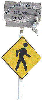
Somewhere" and the "Republic of Whangamomona Independence
Day". What? A republic in New Zealand. You're
right. Each year, the tiny settlement along the Forgotten
World Highway (aka SH43) celebrates
its "independence". We started our journey from Te Wera
and took the Aotuhia-Whangamomona Road (yes, it is a public road that
you enter at your
own risk!) to Whangamomona.
With a new bridge built, the road don't suffer from vertigo (200m sheer drops in
several places), the views are excellent. You feel a world away
from civilisation.
As you can see from the photos, 4WD isn't just about driving. Apart
from the usual digging, the things we had to do on this trip included
putting a small bush fire,
findiing ways to fool the clever horses so that they stay on the right side of the
farm gate and building tracks - skills that a townie would not normally
have! |
|

Henry at the Bridge to Somewhere |

Edith at the Bridge to Somewhere |

Putting out a small bush fire |

Better be stuck than roll 200m down
the bank |
|

With only a few inches on either side |

How do we move these clever
horses? |

Arriving at Whangamomona |

Polling booth at Whangamomona |
|

Read
before you drive |
Day two (Aotuhia Station)
We woke up to the news that our trip leader had a wee accident
overnight while travelling back to the camp via the back road around
midnight (imagine
negotiating the narrow, rutty, dusty track in the dark but no, the
accident happend after the truck was back on gravel). So we
were split into two groups - those with extra recovery gear such as a
winch had the chance to practise their recovery skills - getting a truck
that had rolled off a 20m bank back onto the track! Having viewed
the accident scene, the rest of us without the extra recovery gear journeyed on to the
2,500 hectare farm laced with
pungas.
There were narrow bridges to cross, tight corners to turn, knee-deep
bogs that needed to be drained and bridged, and orientation. After lunch, the group
decided to go for a walk and look for a waterfall. The two farm
workers who guided us on the tracks had no idea where the waterfall was and only pointed us
towards the general direction where it was meant to be. We
scrambled through the bush and finally found the waterfall. Just
before reaching the waterfall, we noticed some orange markers.
Despite this, we still had fun
finding our way back. Ironically, it was a boy called Holmes who led us
home, and the group discovered that the starting orange marker was right in front of one of the
trucks (not ours)! |
|

PERSEF resting belly up in the stream, 20m down the bank |
|

The Bridge to Somewhere
from a distance |
|

Colin & Verity directing a tight
turn |

Another narrow bridge to cross |

Found the waterfall at last! |

Henry negotiating a tight bend |
|

What's waiting if you roll |

Track building at a boggy patch |

Punga
logs bridgenearly finished |

Henry crossing the boggy part |
|

One of the tunnels in the forest |
Day three (Ernie's Place)
After
a good night's sleep, we started the day by heading towards Waverley and
made a trip to see the legendary Ernie. In
his eighties Ernie is as fit as a fiddle. He has been living on a
farm tucked away at the end of the Moeawaea Valley, inland Waverley,
since the 1950s. Ernie has no phone, no electricity, no TV and no
car but a wide collection of items around his property. His
letterbox at the farm gate is 14km from the house. It took us 45
minutes just to get back to the gate from Ernie's house on a rainy
day. Can you imagine walking 30km to collect your mail? The
track to Ernie's place is closed in winter. With the typre
pressure down to 20psi, we were still sliding a bit. There're
magnificent views and steep gorges on the way but it just would not be
possible or prudent to stop for photos! |
|

Ernie's
Place
|
